Gearing Up...
I was
itching to get out for one last backpacking adventure this year, so despite the
questionable weather forecast, I decided to make a go of it from Friday to
Sunday, October 19-21. My goal was to hike the northern loop of Algonquin Park’s
Western Uplands Trail, which promised to be much quieter than the southern
section. I was dismayed to read that the Kearney permit office was closed for
the season, but subsequently pleased to find out that it was still open Friday
to Sunday until the end of October. This saved me over an hour’s worth of
driving. I decided to take a chance and not book any sites until arrival – the
northern reservations were extremely sparse, so I was not too concerned. The
temperatures promised to be on the chilly side, so I packed extra/warm clothing
along with my larger sub-10 sleeping bag. This required using my larger
backpack and ended up being about 35 pounds all packed with food and water. A
bit more than I like when solo, but reasonable, I think, given the circumstances.
Thursday PM:
It was a bit
of a late departure to my friend’s place in Bracebridge, which would be my
Friday morning launching point. I arrived at 10:40 and the natural thing to do
was catch up over a pint (or three). Needless to say, Thursday evening lengthened
and Friday morning came very soon…
Friday:
A chilly but
beautiful morning awaited me. After a much appreciated breakfast of bacon, eggs
and toast, I set off to the Kearney office, arriving there just before 9 AM. I
booked my stays at Loft Lake (Friday) and North Pincher Lake (Saturday). I
always forget how long the road is to Rain Lake, not that it really
mattered. I felt a strange combination of eagerness and relaxation as I
drove towards the trailhead. The road itself was in reasonably good condition,
with the exception of a couple sections with some rather monstrous potholes. I
pulled in to a nearly vacant parking lot, where I was greeted by another solo
backpacker prepping to head to Islet Lake for a couple of nights. After
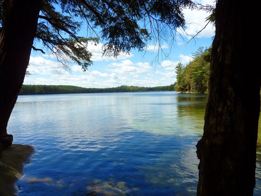
parting ways, I began a quick-paced hike along the first section of trail which
traverses a long-defunct rail line. The first 8.5 km’s went very fast, and it
felt good entering the more rugged section before Ishkuday Lake. There was not
much wildlife to be seen, aside from encountering a number of grouse over the
course of the hike.
 |
| Rain Lake early on - notice the railway tie from the long defunct line |
 |
| Path following Rain Lake |
 |
| Grouse - I encountered several of these during my hike |
 |
| The picture doesn't do justice to the crisp white flowers (or seeds?) topping these plants |
 |
| The trestle remnant at Islet Lake stands as a monument to past times |
As I passed
the junction at Ishkuday, I met two other hikers along with their canine
companion. We chatted briefly, and I learned that they were finishing up the same
hike that I was doing, but in the other direction. I would encounter no one else on the trail afterwards. The day thus far was
spectacular – mild and sunny with almost no foliage, allowing one to see great
distances through the woods. Brown Lake came up quicker than expected, and I
decided to crash at the first (northern) site for some lunch. The sky was
starting to cloud over and the wind was becoming cooler, but I held on to the
hope that all would remain dry until I reached my destination of Loft Lake.
 |
| Beautiful sunshine streaming through the bare trees |
 |
| Not the trail - likely an old logging road |
 |
| Small stream with waterfalls just north of Brown Lake |
 |
| Brown Lake - my lunch stop |
The junction
point south of Brown Lake was a welcome site as I started my final leg to Loft
Lake. The trail became noticeably less traversed, and it was obvious that it
hadn’t garnered much attention from a maintenance perspective either. The trail
that time forgot. In short, it was awesome! I took a break at East End Lake and
remarked how much the landscape had changed since I had been there in 2014,
which was shortly after a local fire at the site (which was unfortunate as I
kind of fell in love with this little site the first time I was there in 2012).
Things were getting greener again! A cold, strong wind whipped off the lake,
reminding me that I best press on before the rain.
 |
| Bridge over the Brown Creek's wide expanse - see if you can find the bench in the middle of it. |
 |
| Remnants of old 'bridge' over same waterway. I remember the old flimsy and failing structure well and appreciated my waterproof hiking boots at the time while walking over the semi-submerged logs |
 |
| View from bridge, looking toward direction of Brown Lake |
 |
| Junction point. A portage acts as a shortcut to Gervais Lake to shorten the 3rd Loop. No shortcuts for me! |
 |
| View from up top of Potter Creek after crossing it |
 |
| The section of trail that Maintenance Crews forgot about... - the rotted logs were once part of a structure atop the wet ground. |
 |
| East End Lake - the second site that I ever stayed on in Algonquin's back country, years ago |
 |
| The landscape at the camp site rejuvenates after a forest fire several years ago. |
The section
of trail between East End and Loft Lake was a bit of a haul, which is usually
the case near the end of a longer trek day – in this case 22 km. I arrived at
my home for the night well before 4:00 and immediately setup camp in
light of the threatening weather. After getting the tarp and tent up, I took a
short break and drank in the scenery, along with the contents of my cup. I had
chosen the northern site at Loft, and was not disappointed. It boasted great
views of the lake along with a stretch of quasi-sandy beach which would have
been great several months ago. I foraged some firewood, and it didn’t take
long to find some nice dead fall maple limbs. As I was collecting, I noticed a
couple rusted out fuel containers and what may have been a large enamel pot –
likely remnants of some logging activities many decades ago. Unfortunately, I
didn’t have my camera with me at the time, but I committed to memory the spot
should I ever return there…
 |
| Humongous fungus - the size of a dinner plate! |
 |
| Waterfront at Loft Lake camp site - the entrance into the water is pleasantly sandy |
 |
| Late afternoon at Loft Lake |
 |
| The Big Agnes Scout UL2 Tent |
 |
| Tarp shelter |
A light rain
descended as I was getting my fire going. Fortunately, it stayed light and was
intermittent and did not force me under my tarp or tent. It was fully dark by
7:00, and after enjoying a bit more fire time, I turned in early. My Merino
wool under layer and -10 sleeping bag kept me plenty warm during the night,
although I missed my thicker blow up pad (I took along a Thermarest pad because
of the cold temps). I tucked my water filter into the bag with me as a
precaution, although I don’t believe it got down to zero at any time. It rained
off and on throughout the night, but aside from the occasional drops it was
exceptionally quiet outside.
 |
| A small, hot fire of maple logs - cozy and warm |
Saturday:
I woke up a
number of times during the night, which I have a habit of doing when in the
back country. The rain stopped as dawn arrived, and I emerged from my tent to
meet the damp morning. The sun started to peek out from the clouds, and I
relished its rays, especially with today’s cooler temperature. The sky was
still threatening though, so I decided not to gamble and try to pack my tent
and its contents asap. The tent itself was very wet, so I did my best to dry it
off with a ShamWow (thanks Vince!) and give it a good shake out. I hate packing
a damp tent, but what do you do…? I had just finished packing it
all up when a solid rain came pounding down. I huddled under my tarp and boiled
water for coffee and breakfast, hoping that I wouldn’t have an overly wet
hiking day ahead of me. The rain stopped in less than half an hour though, and
despite the dubious forecast it held off for the rest of the day – sweet.
I only had about
13 km to trek today, so I was in no particular hurry. The trail was fairly wet
and muddy in spots, requiring some fancy footwork. Soon into my hike, I spotted
an old galvanized tub laying about 15 or 20 feet in the woods. I questioned how
such an item found its way here, as I scoped the area for other things –
unsuccessfully. It didn’t take long to reach the bottom of the third loop
heading towards West Otterpaw with some more challenging trail conditions and
some fun water crossings awaiting me.
 |
| Large galvanized bucket - there's no way you would see this during summer's foliage. It is at this point where I notice my camera battery is running low, likely due to the cold temperature |
West Otterpaw
creek proved to be a particular challenge due to the swelled streams. The
options were crossing on top of a beaver dam or over some partially submerged
rocks downstream. I thought the beaver dam would be the best option. I thought
wrong. The volume of water cascading over the dam gave me a semi-soaker, and so
precarious rock hopping proved to be less of a challenge after all. Nearing
West Otterpaw Lake, the trail appeared to cross another small stream and
continue straight on. Soon after I crossed however, the trail ended and I could
not see any well travelled footpath. I checked out a couple of paths that did
not go far in, and zig zagged a couple of times to try and figure it out. The
uniform landscape of fallen leaves did not help. I checked my map and ended up
crossing back over the stream, only then seeing a ragged piece of orange
flagging tape on a tree a little ways off. Turns out that the trail does a hard
90 degree turn by the stream vs. crossing it! It kind of jogged my memory of when
I came this way several years back and likely ran into the same dilemma…
 |
| Yes, this is part of the trail... |
 |
| Saw this little guy sunning himself on the trail - I get one last shot and then my camera battery dies. |
Otterpaw Lake
was a welcome view, and it wasn’t long before I hit the junction at Gervais
Lake. I considered having lunch at the site, but decided to keep going to
Tern Lake. There are a fair number of terrain ups and downs getting to Tern,
and it certainly worked up my appetite. I had a quick lunch of PB and chocolate
tortillas at the eastern site as a final energy boost to press on to my
destination of North Pincher.
The cool,
windy weather was holding steady and I was thankful that it had stayed dry all
along. It wasn’t much further before I would hit Pincher Lake, and I was trying
to recall the spacious site on North Pincher that I stayed at a few years ago. After
examining the two most southern ‘North’ sites, I quickly realized the third one
up was indeed the prime spot on the lake. I arrived shortly after 3:00 pm and
setup the night’s camp. I debated on putting up the tarp due to the high winds,
but figured I’d best do this in case of rain which, thankfully, never arrived.
After a self-congratulatory
beverage, I setup a rope for hanging the food bag and scoured the area across
the trail for the evening’s firewood. It didn’t take long to find my preferred dead fall
maple limbs, but dry downed tinder/softwood to get the fire going was in a bit
shorter supply. Fortunately, the wind died down toward dusk, as it often does,
and I got a nice fire going while cooking a pot of KD. My socks and boots were
still soggy and I tried my best to dry everything out by the fire with limited
success. After the routine food bag hang as it darkened, I sat down by the fire
a while longer before turning in relatively early once again.
I could hear
a light rustling outside my tent as I laid down to sleep and suspected it was a
mouse. My suspicions where confirmed when I saw the silhouette of the creature
crawling on the top of my tent. I smacked the tent hard, launching the mouse to
who-knows-where, which was enough to keep it away henceforth. The wind picked
up overnight and I awoke a number of times feeling the cold air and the gusts
that were literally lifting up the tent around me. Being an ultralight tent, I
had some concerns that it would collapse at some point, but mercifully it held
up like a champ.
Sunday:
As daylight
beckoned, I arose to a cold, partly sunny morning. I fumbled for my boots and
was wondering why they felt so stiff. I then clued in that they were damp the
night before and now frozen solid. I clunked about in my icy footwear like
Frankenstein’s monster until the heat of my feet thawed them out again. The
wind was still kicking up, and the chill was considerable. A trace of snow had
fallen, and it was the first I had seen of it this season. I quickly filtered
some water and immediately disassembled the kit before things froze up, tucking the filter in my sweater pocket. The
wind was so chilly that the water at the bottom of my cup froze within several
minutes. I don’t think instant coffee was ever appreciated as much as on this
morning. After some oatmeal, I hastily packed up camp to get moving and keep
warm. I was hiking back to the trail head at Rain Lake today, a little over 22
km away.
Good news:
my boots were now fully pliable. Bad news: my feet were now frozen. I stopped
several hundred metres into my hike to remove my boots and vigourously rub my
feet to restore circulation. This did the trick, and my feet were warm (along
with the rest of me) the entire time afterwards. The morning wind died down,
and the landscape became eerily silent. Cold, desolate, stark - and beautiful.
I stopped
for a brief snack at the waterfall exiting the north end of Stutter Lake, lamenting
my camera’s dead battery. Despite the coldness, or perhaps because of it, I was
really appreciating my surroundings today. Reaching the summit at Stammer Lake,
I peered through the trees as best I could and spotted McCraney Lake in the
distance. It wouldn’t be long and I would be encountering the more commonly
used Islet Lake and I was grateful for my time of solitude back here.
I thought I
may encounter a camper or two at Islet Lake, but anyone who may have been there
had vacated before I arrived. There is one backpacking site that is right on
the trail, and I did see some ice emptied out from a receptacle of one form or
another lying on the ground. No doubt the individual behind this was as
surprised as I was regarding the cold when they got up in the morning! The rest
of the hike back to the car was uneventful, and the last 9 km’s of the trail
flew by. It felt great to hike, but a bigger part of me was looking forward to
getting back to the car and then home to my family.
I made it
out just before 2:00 pm and immediately got going after changing my footwear. I
stopped briefly at the Kearney Community Centre where the permit office is located and
texted my wife to let her know I was on my way. As the drive back toward the
city became busier the further south I went, I felt gratitude for the ability
of getting away to Algonquin once again. I hope this feeling returns at many
future points.