ALS Memorial Hike - May 30 to June 1, 2014
This hike is dedicated to my father in law who passed away from ALS (Lou Gehrig's) last year, and to the ALS Society that offered tremendous support when it was most needed.
My goal was to complete the 75 k perimeter of Algonquin Park's Western Uplands Trail solo in 3 days. I had to take a minor detour at one point, so it ended up being about 77 k instead. Below is a summary of the hike in pictures with captions that detail the journey - they are in chronological order.
The weather was pretty much perfect, but the black flies and mosquitoes were both at their peak - oh well, you can't have it all!
Wildlife encounters included:
- 2 bear cubs
- 2 moose (cows)
- 1 deer (buck)
- 1 grouse
- 2 woodpeckers
- various waterfowl, including loons
- owl (heard, not seen, just before going to sleep on day one)
- hundred of chipmunks and squirrels
- millions of black flies and mosquitoes
 |
| Sign at trail head, off of Highway 60 near park's West Gate |
 |
| A few hundred metres in, the trail branches - I'll be going in on the left and coming out on the right |
 |
| Early on… |
 |
| Hard to believe a rodent can build these things |
 |
| One of several bridge styles to cross over creeks and wet areas |
 |
| Water running over smooth rocks |
 |
| Maple Leaf Lake - the first major lake on the trail and a great spot to take a break |
 |
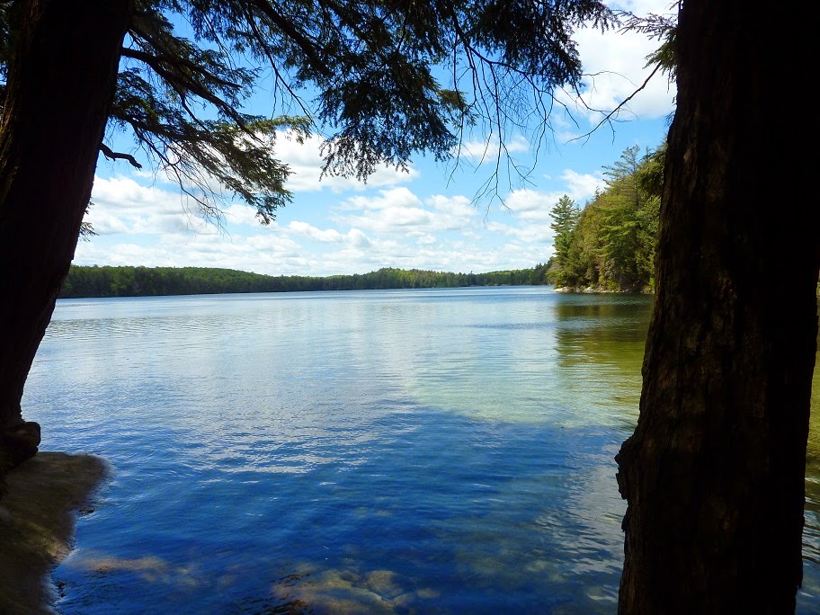
| One of the very few distance views afforded on this trail |
 |
| Some bridges are home made - the pole stuck in the ground came in pretty handy to maintain some steadiness and avoid a soaker (thanks to whomever did this!) |
 |
| Little Hardy Lake - there's a natural sand beach at the lone campsite on this lake |
 |
| View from the southern site at Steeprise Lake |
 |
| …still a few trilliums in bloom |
 |
| Maggie Lake - great place for a lunch stop and to replenish my water supply |
 |
| Maggie Lake, another view |
 |
| Maggie Lake looked like a nice swimming spot until I saw these things - I didn't think leeches could get this big! |
 |
| Taking the 1st loop affords one a 32 km hike - I proceed on to the 2nd loop. |
 |
| A small waterfall coupled with a flat rocky clearing - a perfect spot to take a break |
 |
| Bridge over Big East River - the newest (and nicest) bridge on the trail. I take a final break at the remnants of a de-commissioned campsite - just 5 k left to my first night's campsite and fatigue is starting to set in |
 |
| Bean's Boulder - a massive glacial deposit |
 |
| Probably the toughest section of trail is between Big East River and Clara Lake, with lots of ups and downs and twist and turns on some tough ground |
 |
| Another uphill - I'm just wanting to get to camp at this point |
 |
| I arrive at Clara Lake at 4:30 and take a rest, admiring the views before setting up camp. |
 |
| The humble tent |
 |
| All food and scented items are packed in a 'bear bag' and hung well off the ground. Forget the bears - chipmunks are actually the worst for stealing food... |
 |
| A small fire to deter the insect clouds and give some warmth in the early evening |
 |
| View of Clara Lake as I set off on Day 2 |
 |
| One of many rugged bridges |
 |
| Nice forest view - it's very warm and still today |
 |
| Taking the 2nd loop allows for a 55 km hike - I keep going on the 3rd loop |
 |
| Pincher Lake - there are several great campsites on this lake |
 |
| Stutter Lake |
 |
| Sorry for the mess up - turn your head 90 degrees to the right to see a nice waterfall... |
 |
| Lookout view of Stammer Lake - it is soon after this point where I see my first moose on the journey and we cross paths about 15 metres from each other. I try to get a picture of the moose, but it's moving quickly behind the trees and I can't get a clear shot |
 |
| Aptly named Islet Lake - it is here where I encounter 2 very pleasant park workers, the only people I'll see during the entire hike |
 |
| Brown Lake - only 5 k's to my second night's camp (and yes, I'm feeling it). I spot my second moose of the day soon after I leave from here |
 |
| The top of the beaver dam is actually part of the trail and my camp at East End Lake is getting close. Unfortunately, I spot 2 bear cubs about 30 metres away just as I arrive there - they climb a dead tree in panic of my presence and I don't know where the mother is lurking. There's no way I'm camping here and proceeding on the trail would bring me closer to the cubs that are hemmed in by the lake on the other side - a bad situation… Avoidance is clearly the best action, so I turn around and head back 2 k's to another section of trail that connects me to the southern part of the 3rd loop where more campsites are located |
 |
| Campsite at West Otterpaw Lake - about 6 k's from East End Lake and more than 30 k's of total hiking today - adrenaline got me here from East End, and I am completely exhausted |
 |
| The cheap and reliable cat food can stove fueled by methyl hydrate - I'm super hungry tonight |
 |
| The 3rd and final day - heading past the 2nd loop junction on the east side of the loop |
 |
| Rainbow Lake |
 |
| Lookout view of Susan Lake - a perfect, sunny day with not a single cloud in the sky |
 |
| The long climb up from Susan Lake |
 |
| …and then back down again |
 |
| Picture taken from a campsite on Lupus Lake |
 |
| 1st loop junction on the east side of the loop - less than 10 k's to go now |
 |
| Ramona Lake - I stop here for a rest and final water re-fill |
 |
| Guskewau Lake - the last lake, about 4 k from where I complete the trail |
No comments:
Post a Comment